1950 Map of Effingham
USGS Topo · Published 1963About this map
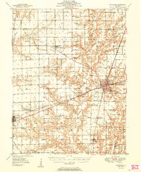
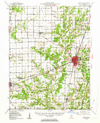
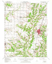
Effingham serves as a major transportation crossroads in this mid-century survey, where the Illinois Central, Pennsylvania, and Baltimore and Ohio railroads converge. The landscape is defined by the winding course of the Little Wabash River and its numerous tributaries, including Moccasin Creek and Salt Creek, which carve through the till plains of Effingham and Shelby counties. The map captures a high density of rural social centers from a disappearing era, recording dozens of country schools like Ewington Sch and Mound Sch alongside family and parish landmarks such as Miller Chapel and St Marys Cem. Small agricultural hubs including Shumway, Watson, and Altamont are meticulously detailed, showing the layout of streets and grain-side rail sidings. Of particular interest to local historians is the site of the County Airport and the early Radio Tower WCRA, signaling the post-war modernization of the region.
Find a feature on this map
96 named features on this map. Tap any name to fly to it.
Don’t see what you’re looking for? This feature index may not catch every label — zoom into the map to look around manually.
Map Details
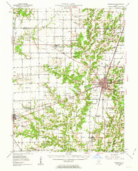
Editions of this 1950 Effingham Map
4 editions found
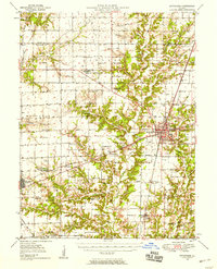
Historical Maps of Effingham Through Time
3 maps found