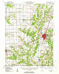
1950 Map of Effingham
USGS Topo · Published 1964About this map
Effingham serves as the central hub of this mid-century Illinois landscape, where the Pennsylvania and Illinois Central railroads intersect. The city is a node of transport and communication, featuring the Radio Tower WCRA, the County Airport, and a developed street grid. Beyond the city center, the terrain is defined by the Little Wabash River and its numerous tributaries, such as Salt Creek and Blue Point Creek, which carve through the agricultural townships.
Find a feature on this map
103 named features on this map. Tap any name to fly to it.
Don’t see what you’re looking for? This feature index may not catch every label — zoom into the map to look around manually.
Map Details
Editions of this 1950 Effingham Map
4 editions found

Other maps of this area

1934 · Mattoon
USGS Topo · 1:62,500

1937 · Mattoon
USGS Topo · 1:62,500

1941 · St. Elmo
USGS Topo · 1:62,500

1942 · Shelbyville
USGS Topo · 1:62,500

1945 · St. Elmo
USGS Topo · 1:62,500

1945 · Kinmundy
USGS Topo · 1:62,500

1946 · Shelbyville
USGS Topo · 1:62,500

1947 · Kinmundy
USGS Topo · 1:62,500

1947 · Stewardson
USGS Topo · 1:62,500

1949 · Stewardson
USGS Topo · 1:62,500