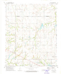
1972 Map of El Reno NE
USGS Topo · Published 1974About this map
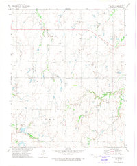
Cottonwood Creek and Uncle Johns Creek carve a series of drainage patterns across this section of the Oklahoma prairie in the early 1970s. The landscape is defined by its transition from open agricultural spaces like Lynn Downs Field to the expanding municipal footprints of Piedmont and El Reno. A distinctive diagonal line is drawn by the Frisco rail line, which cuts across the southern portion of the quadrangle, while an Old Railroad Gr in the southeast corner provides a window into the area's changing transportation network. The presence of Mathewson Cem and Palmer Cem offers specific points of interest for genealogists tracing local families, and a large feedlot in the north reflects the region's enduring cattle-ranching heritage during this era of rural development.
Find a feature on this map
18 named features on this map. Tap any name to fly to it.
Don’t see what you’re looking for? This feature index may not catch every label — zoom into the map to look around manually.
Map Details
Editions of this 1972 El Reno NE Map
2 editions found
Other maps of this area

1892 · Kingfisher
USGS Topo · 1:125,000

1895 · Kingfisher
USGS Topo · 1:125,000

1954 · Oklahoma City
USGS Topo · 1:250,000

1957 · Oklahoma City
USGS Topo · 1:250,000

1963 · Oklahoma City
USGS Topo · 1:250,000
1966 · Bethany
USGS Topo · 1:24,000

1966 · Piedmont
USGS Topo · 1:24,000
1970 · Cashion
USGS Topo · 1:24,000
1972 · Kingfisher SE
USGS Topo · 1:24,000
1972 · El Reno
USGS Topo · 1:24,000