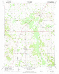
1961 Map of Elberfeld
USGS Topo · Published 1973About this map
The town of Elberfeld and its surrounding coal-mining and agricultural landscape are documented in this detailed topographic study. The presence of the Elberfeld Mine south of the town center, along with numerous Oil Wells scattered across the northern sections, points to a mid-century economy driven by resource extraction. Local transit is dominated by the New York Central railroad, which links the settlements of Buckskin and Elberfeld, crossing a terrain carved by Pigeon Creek and the historical trace of the Wabash and Erie Canal.
Find a feature on this map
54 named features on this map. Tap any name to fly to it.
Don’t see what you’re looking for? This feature index may not catch every label — zoom into the map to look around manually.
Map Details
Editions of this 1961 Elberfeld Map
4 editions found
Other maps of this area

1901 · Princeton
USGS Topo · 1:62,500

1901 · Haubstadt
USGS Topo · 1:62,500

1902 · Ditney
USGS Topo · 1:125,000

1902 · Boonville
USGS Topo · 1:62,500

1903 · Haubstadt
USGS Topo · 1:62,500

1903 · Petersburg
USGS Topo · 1:62,500

1903 · Princeton
USGS Topo · 1:62,500

1903 · Patoka
USGS Topo · 1:125,000

1956 · Vincennes
USGS Topo · 1:250,000

1957 · Vincennes
USGS Topo · 1:250,000