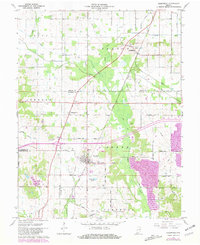
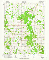
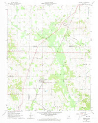
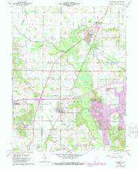
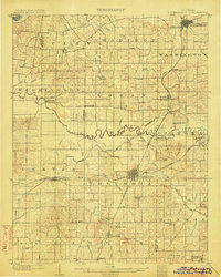
1961 Map of Elberfeld
USGS Topo · Published 1981About this map
Elberfeld serves as the primary hub in this southwestern Indiana landscape, where the local economy transitions from traditional agriculture to industrial extraction at the Elberfeld Mine. The map reveals a complex water network centered on Pigeon Creek and its many tributaries, including Smith Fork and Big Creek. While the Erie Canal remains a visible historical corridor, modern transportation is represented by Conrail rail lines and a grid of rural roads like Old Petersburg Rd.
Find a feature on this map
44 named features on this map. Tap any name to fly to it.
Don’t see what you’re looking for? This feature index may not catch every label — zoom into the map to look around manually.
Map Details
Editions of this 1961 Elberfeld Map
4 editions found
Other maps of this area

1901 · Princeton
USGS Topo · 1:62,500

1901 · Haubstadt
USGS Topo · 1:62,500

1902 · Ditney
USGS Topo · 1:125,000

1902 · Boonville
USGS Topo · 1:62,500

1903 · Haubstadt
USGS Topo · 1:62,500
1903 · Petersburg
USGS Topo · 1:62,500
1903 · Princeton
USGS Topo · 1:62,500

1903 · Patoka
USGS Topo · 1:125,000

1956 · Vincennes
USGS Topo · 1:250,000

1957 · Vincennes
USGS Topo · 1:250,000