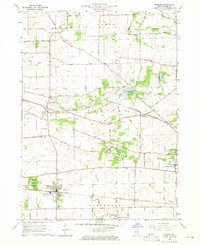
1964 Map of Elburn
USGS Topo · Published 1965About this map
The village of Elburn serves as a primary hub for the Chicago and North Western railroad during the mid-1960s, while the Chicago Great Western line bisects the landscape to the north near Wasco. This area of Kane County reveals a transition between established agricultural townships like Plato and Campton and emerging suburban developments. The map highlights several institutional sites, most notably the Broadview Academy and the State Training Sch for Boys on the eastern edge. Local genealogy is well-documented through a high density of burial grounds, including the New Hampshire Cem, Whitney Cem, and the St Gall Cem north of the Elburn village limits. Natural features such as Blackberry Creek, Ferson Creek, and the Elburn Forest Preserve provide a counterpoint to the network of gravel pits and transit lines that drive the local economy.
Find a feature on this map
57 named features on this map. Tap any name to fly to it.
Don’t see what you’re looking for? This feature index may not catch every label — zoom into the map to look around manually.
Map Details
Editions of this 1964 Elburn Map
3 editions found
Other maps of this area

1925 · Elgin
USGS Topo · 1:62,500

1932 · Geneva
USGS Topo · 1:62,500

1937 · Sycamore
USGS Topo · 1:62,500

1938 · Genoa
USGS Topo · 1:62,500

1940 · Elgin
USGS Topo · 1:62,500

1948 · Geneva
USGS Topo · 1:62,500

1949 · Geneva
USGS Topo · 1:24,000

1950 · Aurora North
USGS Topo · 1:24,000

1954 · Rockford
USGS Topo · 1:250,000

1955 · Rockford
USGS Topo · 1:250,000