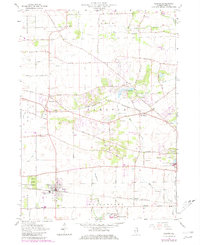
1964 Map of Elburn
USGS Topo · Published 1981About this map
Elburn and the surrounding agricultural landscape of Kane County are defined here by a network of drainage ditches and family-named farm roads. The Chicago and North Western railroad provides the primary industrial spine for the region, connecting the small grain and transit hubs of Wasco, Lily Lake, and La Fox. The map captures a transition period in rural land use, showing early residential clustering around Lake Campton alongside established institutions like the Broadview Academy and the State Training Sch for Boys. Genealogists will find significant value in the numerous burial grounds documented, including the St Gall Cem, New Hampshire Cem, and the Blackberry Cem south of town. The terrain across Campton Hills and the winding course of Blackberry Creek reveal a landscape that, while largely cultivated, still retained large tracts of wooded land preserved at the Elburn Forest Preserve.
Find a feature on this map
62 named features on this map. Tap any name to fly to it.
Don’t see what you’re looking for? This feature index may not catch every label — zoom into the map to look around manually.
Map Details
Editions of this 1964 Elburn Map
3 editions found
Other maps of this area

1925 · Elgin
USGS Topo · 1:62,500

1932 · Geneva
USGS Topo · 1:62,500

1937 · Sycamore
USGS Topo · 1:62,500

1938 · Genoa
USGS Topo · 1:62,500

1940 · Elgin
USGS Topo · 1:62,500

1948 · Geneva
USGS Topo · 1:62,500

1949 · Geneva
USGS Topo · 1:24,000

1950 · Aurora North
USGS Topo · 1:24,000

1954 · Rockford
USGS Topo · 1:250,000

1955 · Rockford
USGS Topo · 1:250,000