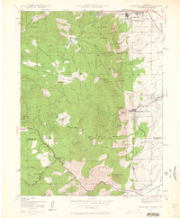
1942 Map of Eldorado Springs
USGS Topo · Published 1961About this map
Eldorado Springs and the surrounding Front Range foothills are documented here during the early 1940s, highlighting a landscape of steep canyons and mountain parks. The Denver and Salt Lake railroad winds through the southern terrain, connecting remote points like Plainview and the Coal Creek Store. Higher elevations are marked by the presence of cattle operations and early settlements such as Kossler Ranch and Walker Ranch, alongside mining traces like the Copeland Mine.
Find a feature on this map
51 named features on this map. Tap any name to fly to it.
Don’t see what you’re looking for? This feature index may not catch every label — zoom into the map to look around manually.
Map Details
Editions of this 1942 Eldorado Springs Map
4 editions found
Other maps of this area

1899 · West Denver
USGS Topo · 1:125,000

1902 · Boulder
USGS Topo · 1:62,500

1904 · Niwot
USGS Topo · 1:62,500

1904 · Boulder
USGS Topo · 1:62,500

1906 · Blackhawk
USGS Topo · 1:62,500

1939 · Golden
USGS Topo · 1:24,000

1942 · Eldorado Springs
USGS Topo · 1:24,000

1942 · Golden
USGS Topo · 1:31,680

1942 · Louisville
USGS Topo · 1:31,680

1942 · Tungsten
USGS Topo · 1:24,000