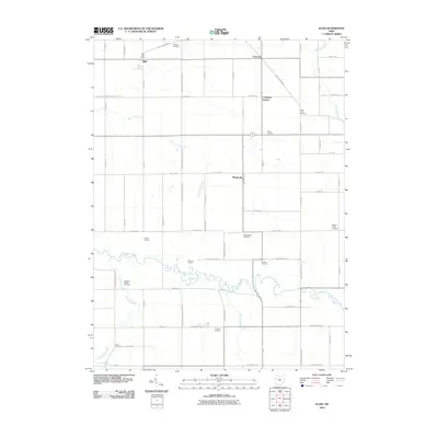
2010 Map of Elgin
USGS Topo · Published 2010About this map
Elgin serves as a focal point in this Western Ohio landscape, situated just north of the Van Wert Mercer County Line Rd. The village is anchored by the Elgin Post Office and surrounded by a network of rural settlements including Converse, Converse Station, and Monticello. The terrain is defined by its watercourses, most notably the meandering Saint Marys River which winds through the southern portion of the quadrangle, joined by tributaries such as Kyle Prairie Creek, Eightmile Creek, and Hussey Creek.
Find a feature on this map
70 named features on this map. Tap any name to fly to it.
Don’t see what you’re looking for? This feature index may not catch every label — zoom into the map to look around manually.
Map Details
Editions of this 2010 Elgin Map
This is the sole edition of this map. No revisions or reprints were ever made.
Other maps of this area

1911 · Spencerville
USGS Topo · 1:62,500

1911 · Delphos
USGS Topo · 1:62,500

1914 · Celina
USGS Topo · 1:62,500

1914 · Van Wert
USGS Topo · 1:62,500

1944 · Delphos
USGS Topo · 1:62,500

1944 · Van Wert
USGS Topo · 1:62,500

1944 · Celina
USGS Topo · 1:62,500

1944 · Spencerville
USGS Topo · 1:62,500

1953 · Muncie
USGS Topo · 1:250,000

1956 · Muncie
USGS Topo · 1:250,000