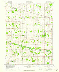
1960 Map of Elgin
USGS Topo · Published 1961About this map
The St Marys River meanders through this landscape at the junction of Van Wert, Allen, Mercer, and Auglaize counties, defining a region of productive farmland and small rail-oriented settlements. The Erie Lackawanna Railroad cuts across the northern half of the area, serving the village of Elgin and the nearby community of Converse. This era shows a well-established network of country roads named for local families, including Wilshire Road and Marbaugh Road, which connect numerous rural landmarks. Genealogists will find a wealth of local history preserved in the distribution of country churches and small burial grounds, such as Pleasant Grove Ch, Fissel Lauth Cem, and Hance Cem. Several Oil Wells are scattered across the southern sections, indicating the localized petroleum activity that supplemented the area's primary agricultural economy during this period.
Find a feature on this map
86 named features on this map. Tap any name to fly to it.
Don’t see what you’re looking for? This feature index may not catch every label — zoom into the map to look around manually.
Map Details
Editions of this 1960 Elgin Map
This is the sole edition of this map. No revisions or reprints were ever made.
Other maps of this area

1911 · Spencerville
USGS Topo · 1:62,500

1911 · Delphos
USGS Topo · 1:62,500

1914 · Celina
USGS Topo · 1:62,500

1914 · Van Wert
USGS Topo · 1:62,500

1944 · Delphos
USGS Topo · 1:62,500

1944 · Van Wert
USGS Topo · 1:62,500

1944 · Celina
USGS Topo · 1:62,500

1944 · Spencerville
USGS Topo · 1:62,500

1953 · Muncie
USGS Topo · 1:250,000

1956 · Muncie
USGS Topo · 1:250,000