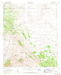
1958 Map of Elgin
USGS Topo · Published 1971About this map
Fort Crittenden and the nearby Fort Buchanan site anchor the historic geography of this high-desert region, situated near the junction of the Southern Pacific railroad and the Sonoita Creek drainage. The landscape is characterized by a dense network of family-held cattle operations, including the Douglas Ranch, Hacienda Los Encino, and the Crown C Ranch, which illustrate the post-war ranching economy of Santa Cruz County. Settlement clusters around the small communities of Sonoita and Elgin, while the Coronado National Forest boundary protects the slopes of Indian Head Mtn and the Canelo Hills. Genealogists will find significant value in the documentation of several remote burial grounds, such as Fruitland Cemetery and Black Oak Cemetery, alongside localized landmarks like the Canille School and the Canelo Ranger Station, providing a detailed look at the rural infrastructure of mid-century southern Arizona.
Find a feature on this map
122 named features on this map. Tap any name to fly to it.
Don’t see what you’re looking for? This feature index may not catch every label — zoom into the map to look around manually.
Map Details
Editions of this 1958 Elgin Map
3 editions found
Other maps of this area

1904 · Patagonia
USGS Topo · 1:125,000

1905 · Patagonia
USGS Topo · 1:125,000

1905 · Nogales
USGS Topo · 1:125,000

1914 · Hereford
USGS Topo · 1:125,000

1915 · Benson
USGS Topo · 1:125,000

1922 · Agus Caliente
USGS Topo · 1:62,500

1922 · Sunnyside
USGS Topo · 1:62,500

1926 · Whetstone
USGS Topo · 1:62,500

1926 · Helvetia
USGS Topo · 1:62,500

1932 · Lochiel
USGS Topo · 1:62,500