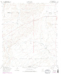
1958 Map of Elgin
USGS Topo · Published 1978About this map
The high grasslands of southern Arizona converge near Elgin, a small ranching hub situated where the Babocomari River and Cienega Creek drainages define the landscape. This survey captures a rural landscape characterized by large land grants and rugged mountain silhouettes, most notably the Mustang Mts to the east and the expansive San Ignacio Del Babocomari grant territory. The map is a vital resource for tracing the remnants of early transportation and settlement, showing the Old Railroad Grade cutting across the terrain toward the south and west.
Find a feature on this map
24 named features on this map. Tap any name to fly to it.
Don’t see what you’re looking for? This feature index may not catch every label — zoom into the map to look around manually.
Map Details
Editions of this 1958 Elgin Map
4 editions found
Other maps of this area

1904 · Patagonia
USGS Topo · 1:125,000

1905 · Patagonia
USGS Topo · 1:125,000

1915 · Benson
USGS Topo · 1:125,000

1926 · Whetstone
USGS Topo · 1:62,500

1932 · Elgin
USGS Topo · 1:62,500

1938 · Huachuca
USGS Topo · 1:62,500

1940 · Elgin
USGS Topo · 1:62,500

1943 · Benson
USGS Topo · 1:125,000

1947 · Elgin
USGS Topo · 1:62,500

1948 · Elgin
USGS Topo · 1:24,000