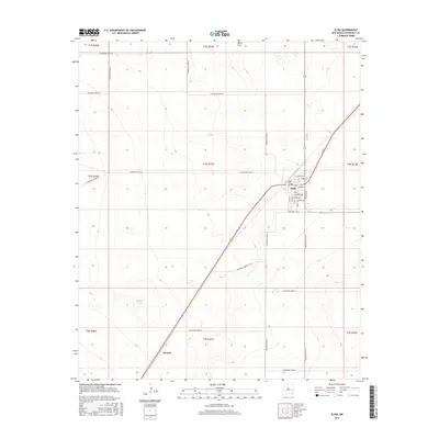
2017 Map of Elida
USGS Topo · Published 2017About this map
Elida serves as the primary hub of this high plains landscape in eastern New Mexico, where a rigid grid of agricultural roads meets the diagonal path of the railway. The town center is densely detailed with residential and civic streets including Jefferson Ave, Texico Ave, and Railroad Ave, reflecting its history as a rail-dependent settlement. Just south of the village center lies the Elida Cem, a significant site for local genealogical research.
Find a feature on this map
38 named features on this map. Tap any name to fly to it.
Don’t see what you’re looking for? This feature index may not catch every label — zoom into the map to look around manually.
Map Details
Editions of this 2017 Elida Map
This is the sole edition of this map. No revisions or reprints were ever made.
Other maps of this area

1954 · Clovis
USGS Topo · 1:250,000

1954 · Brownfield
USGS Topo · 1:250,000

1958 · Brownfield
USGS Topo · 1:250,000

1958 · Clovis
USGS Topo · 1:250,000

1962 · Brownfield
USGS Topo · 1:250,000

1973 · Lewiston Lake
USGS Topo · 1:24,000

1973 · Gammil Well SE
USGS Topo · 1:24,000

1973 · Floyd SE
USGS Topo · 1:24,000
1978 · Elida
USGS Topo · 1:24,000
1979 · Badger Lake
USGS Topo · 1:24,000