
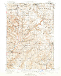
1936 Map of Elizabeth
USGS Topo · Published 1957About this map
Jo Daviess County, in the driftless area of northwest Illinois, is defined by its distinctive landscape of high mounds and deep ridges. At the northern edge, Charles Mound stands near the Illinois-Wisconsin Boundary Line, overlooking a network of rural schools and family-named landmarks like Wenzel Mound and Benton Mound. The settlement of Elizabeth serves as a central hub, surrounded by mining operations such as the Illinois Mine and Skene Mine that speak to the region's lead and zinc extraction history.
Find a feature on this map
93 named features on this map. Tap any name to fly to it.
Don’t see what you’re looking for? This feature index may not catch every label — zoom into the map to look around manually.
Map Details
Editions of this 1936 Elizabeth Map
2 editions found
Other maps of this area

1892 · Savanna
USGS Topo · 1:62,500

1902 · Mineral Point
USGS Topo · 1:125,000

1911 · Elizabeth
USGS Topo · 1:62,500

1911 · Galena
USGS Topo · 1:62,500

1913 · Galena
USGS Topo · 1:62,500

1923 · South Wayne
USGS Topo · 1:62,500

1935 · Miles
USGS Topo · 1:62,500

1937 · Lena
USGS Topo · 1:48,000

1941 · Miles
USGS Topo · 1:62,500

1942 · Mt Carroll
USGS Topo · 1:62,500