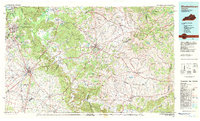
1981 Map of Elizabethtown
USGS Topo · Published 1983About this map
Fort Knox Military Reservation dominates the northern landscape of this Central Kentucky region, where the steep escarpments of Muldraugh Ridge give way to the complex drainage of the Salt River and Rolling Fork. The 1981 survey reveals a landscape deeply connected to heritage and natural preservation, anchored by the Lincoln Memorial National Historic Site near Hodgenville and the expansive Bernheim Forest.
Find a feature on this map
101 named features on this map. Tap any name to fly to it.
Don’t see what you’re looking for? This feature index may not catch every label — zoom into the map to look around manually.
Map Details
Editions of this 1981 Elizabethtown Map
This is the sole edition of this map. No revisions or reprints were ever made.
Other maps of this area

1905 · Harrodsburg
USGS Topo · 1:125,000

1907 · Louisville
USGS Topo · 1:62,500

1909 · Kosmosdale
USGS Topo · 1:48,000

1912 · Kosmosdale
USGS Topo · 1:62,500

1922 · Frankfort
USGS Topo · 1:48,000

1923 · Waddy
USGS Topo · 1:48,000

1924 · Frankfort
USGS Topo · 1:62,500

1925 · Cub Run
USGS Topo · 1:62,500

1925 · Mount Eden
USGS Topo · 1:48,000

1927 · Mount Eden
USGS Topo · 1:62,500