
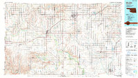
1985 Map of Elk City
USGS Topo · Published 1985About this map
Elk City and Sayre serve as the primary hubs in this western Oklahoma landscape, which shows a sophisticated infrastructure of aviation and energy by the mid-1980s. The presence of the Clinton-Sherman Airport near Burns Flat highlights the area's strategic importance, while industrial features like the Salt Evaporators and various quarries point to the local mineral economy. The terrain transitions from the plains near Meridian to the distinct elevations of the Granite Mountains and Haystack Mountain.
Find a feature on this map
75 named features on this map. Tap any name to fly to it.
Don’t see what you’re looking for? This feature index may not catch every label — zoom into the map to look around manually.
Map Details
Editions of this 1985 Elk City Map
2 editions found
Other maps of this area

1949 · Cooperton
USGS Topo · 1:62,500

1954 · Amarillo
USGS Topo · 1:250,000

1954 · Plainview
USGS Topo · 1:250,000

1955 · Lawton
USGS Topo · 1:250,000

1955 · Clinton
USGS Topo · 1:250,000

1956 · Cordell
USGS Topo · 1:62,500

1956 · Rainy Mountain Creek
USGS Topo · 1:24,000

1956 · Cooperton
USGS Topo · 1:62,500

1957 · Clinton
USGS Topo · 1:250,000

1957 · Butler
USGS Topo · 1:62,500