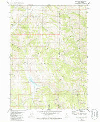
1980 Map of Elk Valley
USGS Topo · Published 1986About this map
The Gannett Hills dominate this high-altitude landscape along the Idaho-Wyoming border, where the Caribou National Forest meets the Bridger National Forest. Surveyed in the early 1970s and edited in 1980, the terrain is defined by a dense network of seasonal drainages and named summits like The Pinnacle and Clover Knoll. The map reveals a land utilized for more than just its natural resources, indicated by a lone Drill Hole and a series of primitive transport routes.
Find a feature on this map
34 named features on this map. Tap any name to fly to it.
Don’t see what you’re looking for? This feature index may not catch every label — zoom into the map to look around manually.
Map Details
Editions of this 1980 Elk Valley Map
2 editions found
Other maps of this area

1909 · Montpelier
USGS Topo · 1:125,000

1911 · Montpelier
USGS Topo · 1:125,000

1915 · Crow Creek
USGS Topo · 1:62,500

1921 · Afton
USGS Topo · 1:125,000

1936 · Cokeville
USGS Topo · 1:96,000

1942 · Cokeville
USGS Topo · 1:125,000

1949 · Stewart Flat
USGS Topo · 1:24,000

1949 · Snowdrift Mountain
USGS Topo · 1:24,000

1951 · Stewart Flat
USGS Topo · 1:24,000
1951 · Snowdrift Mountain
USGS Topo · 1:24,000