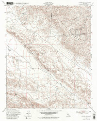
1954 Map of Elkhorn Hills
USGS Topo · Published 1982About this map
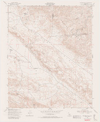
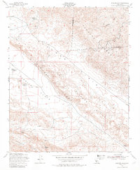
Elkhorn Hills rise sharply between the expansive Carrizo Plain and the Elkhorn Plain, defining a landscape where geology and ranching history are deeply intertwined. This mid-century survey reveals a network of working homesteads across the San Luis Obispo and Kern County line, including Cochora Ranch, AF Traver Ranch, and LE Traver Ranch. The presence of Oil Wells and Oil Tanks in the northern reaches of the Temblor Range signals the region's industrial transitions, while the reliance on isolated water sources like Lawson Spring and Padrones Spring highlights the arid conditions of the terrain. The map also identifies a remote Cem and the Hanline Ranch near the southern slopes of the Caliente Range, providing specific data points for genealogists and local historians tracing the settlement of these interior California basins.
Find a feature on this map
23 named features on this map. Tap any name to fly to it.
Don’t see what you’re looking for? This feature index may not catch every label — zoom into the map to look around manually.
Map Details
Editions of this 1954 Elkhorn Hills Map
6 editions found
Other maps of this area

1902 · Santa Ynez
USGS Topo · 1:125,000

1903 · Mt. Pinos
USGS Topo · 1:125,000

1905 · Santa Ynez
USGS Topo · 1:125,000

1910 · Buena Vista Lake
USGS Topo · 1:125,000

1912 · McKittrick
USGS Topo · 1:125,000

1912 · Buena Vista Lake
USGS Topo · 1:125,000

1942 · Ballinger Canyon
USGS Topo · 1:24,000

1942 · East of Cuyama Ranch
USGS Topo · 1:24,000

1943 · Maricopa
USGS Topo · 1:31,680

1943 · Cuyama Ranch
USGS Topo · 1:31,680