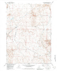
1953 Map of Elkhorn Springs
USGS Topo · Published 1982About this map
Beaver Divide dominates the topography of this Fremont County landscape, marking a significant drainage separation between the northern and southern basins. Recorded in the early 1950s, the terrain reveals a sparse but functional human presence focused on infrastructure and natural resources. A Landing Strip and a single Gas Well near Findlay Lake point to mid-century industrial activity and remote transportation needs. The eastern portion of the map is defined by the high elevations of Long Mountain, where the West Fork and Long Creek headwaters begin their descent. Small-scale water sources like Elkhorn Springs and windmills provide critical points of interest in an otherwise arid expanse, while surveying benchmarks such as VABM 7381 Beaverton serve as permanent geographic anchors for the era.
Find a feature on this map
15 named features on this map. Tap any name to fly to it.
Don’t see what you’re looking for? This feature index may not catch every label — zoom into the map to look around manually.
Map Details
Editions of this 1953 Elkhorn Springs Map
2 editions found
Other maps of this area

1951 · Graham Ranch
USGS Topo · 1:24,000

1951 · Myers Ranch
USGS Topo · 1:24,000

1952 · Tin Cup Mountain
USGS Topo · 1:24,000

1952 · Rongis Reservoir
USGS Topo · 1:24,000

1953 · Blue Gulch
USGS Topo · 1:24,000

1953 · Sweetwater Station
USGS Topo · 1:24,000

1953 · Elkhorn Springs
USGS Topo · 1:24,000

1953 · Sand Draw
USGS Topo · 1:24,000

1953 · Dishpan Butte
USGS Topo · 1:24,000

1955 · Lander
USGS Topo · 1:250,000