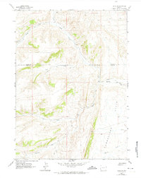
1962 Map of Elkol SW
USGS Topo · Published 1974About this map
The Emigrant Trail cuts a historic path across this high-desert landscape in southwest Wyoming, tracing a route that historically guided travelers through the arid basins between mountain ranges. Set during the early 1960s, the map reveals a rugged drainage system defined by Little Muddy Creek and its various tributaries, including Sheep Creek, Bell Creek, and Ryckman Creek. The topography is dominated by the broad expanse of the Cumberland Flats to the east and the undulating ridges to the west, where the county line separates Lincoln and Uinta counties.
Find a feature on this map
12 named features on this map. Tap any name to fly to it.
Don’t see what you’re looking for? This feature index may not catch every label — zoom into the map to look around manually.
Map Details
Editions of this 1962 Elkol SW Map
3 editions found
Other maps of this area

1954 · Ogden
USGS Topo · 1:250,000

1958 · Ogden
USGS Topo · 1:250,000

1960 · Ogden
USGS Topo · 1:250,000

1962 · Bell Butte NE
USGS Topo · 1:24,000

1962 · Cumberland Gap
USGS Topo · 1:24,000

1962 · Elkol SW
USGS Topo · 1:24,000

1962 · Elkol
USGS Topo · 1:24,000

1962 · Warfield Creek
USGS Topo · 1:24,000

1962 · Bell Butte
USGS Topo · 1:24,000

1965 · Bridger
USGS Topo · 1:24,000