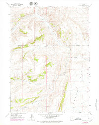
1962 Map of Elkol SW
USGS Topo · Published 1979About this map
The Emigrant Trail traverses the eastern half of this high-desert landscape, following the lower elevations through the expansive Cumberland Flats. This historic corridor is accompanied by a network of seasonal watercourses and drainage systems, most notably Little Muddy Creek, which draws from several tributaries including Bell Creek and Ryckman Creek. Evidence of early mineral exploration is visible on the hillsides, marked by scattered prospect pits and a localized mine near the base of the ridges.
Find a feature on this map
14 named features on this map. Tap any name to fly to it.
Don’t see what you’re looking for? This feature index may not catch every label — zoom into the map to look around manually.
Map Details
Editions of this 1962 Elkol SW Map
3 editions found
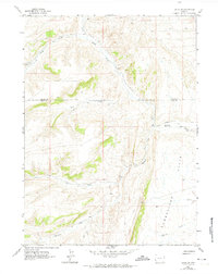
Other maps of this area

1954 · Ogden
USGS Topo · 1:250,000

1958 · Ogden
USGS Topo · 1:250,000

1960 · Ogden
USGS Topo · 1:250,000

1962 · Bell Butte NE
USGS Topo · 1:24,000

1962 · Cumberland Gap
USGS Topo · 1:24,000

1962 · Elkol SW
USGS Topo · 1:24,000

1962 · Elkol
USGS Topo · 1:24,000

1962 · Warfield Creek
USGS Topo · 1:24,000

1962 · Bell Butte
USGS Topo · 1:24,000

1965 · Bridger
USGS Topo · 1:24,000