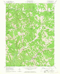
1961 Map of Ellenboro
USGS Topo · Published 1968About this map
Ellenboro serves as a focal point in the southern portion of this landscape, situated at the junction of the Baltimore and Ohio railroad and a network of winding valley roads. The terrain is characterized by intricate drainage patterns, with Bonds Creek and McKim Creek carving deep paths through the hills. This 1958 photogrammetric study captures the region during a period of active resource extraction, evidenced by numerous gas and oil wells scattered across the ridges and hollows, particularly near Adlai and Finch.
Find a feature on this map
53 named features on this map. Tap any name to fly to it.
Don’t see what you’re looking for? This feature index may not catch every label — zoom into the map to look around manually.
Map Details
Editions of this 1961 Ellenboro Map
3 editions found
Other maps of this area

1905 · West Union
USGS Topo · 1:62,500

1906 · Saint Marys
USGS Topo · 1:62,500

1906 · Holbrook
USGS Topo · 1:62,500

1907 · Harrisville
USGS Topo · 1:62,500

1924 · St Marys
USGS Topo · 1:62,500

1924 · Harrisville
USGS Topo · 1:62,500

1924 · West Union
USGS Topo · 1:62,500

1924 · Holbrook
USGS Topo · 1:62,500

1926 · Harrisville
USGS Topo · 1:62,500

1926 · Holbrook
USGS Topo · 1:62,500