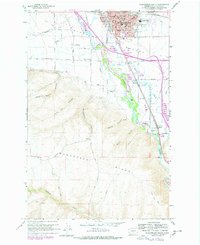
1958 Map of Ellensburg South
USGS Topo · Published 1978About this map
The Kittitas Valley landscape around the southern edge of Ellensburg is defined by the vital waters of the Yakima River and its intricate network of irrigation ditches like Tjossem Ditch. During the late 1950s, the area's transition from a bustling rail hub to an agricultural valley is evident, with the Burlington Northern and the Chicago Milwaukee St Paul & Pacific railroads carving routes through the terrain. To the south, the dramatic rise of Manastash Ridge and the deep cuts of Shushuskin Canyon and Long Tom Canyon create a sharp contrast to the developed townsite.
Find a feature on this map
54 named features on this map. Tap any name to fly to it.
Don’t see what you’re looking for? This feature index may not catch every label — zoom into the map to look around manually.
Map Details
Editions of this 1958 Ellensburg South Map
4 editions found
Other maps of this area

1897 · Mount Stuart
USGS Topo · 1:125,000

1899 · Ellensburg
USGS Topo · 1:125,000

1901 · Ellensburg
USGS Topo · 1:125,000

1902 · Mount Stuart
USGS Topo · 1:125,000

1920 · Colockum Pass
USGS Topo · 1:125,000

1922 · Colockum Pass
USGS Topo · 1:125,000

1938 · Badger Pocket
USGS Topo · 1:48,000

1943 · Badger Pocket
USGS Topo · 1:62,500

1950 · Yakima
USGS Topo · 1:250,000

1953 · Kittitas
USGS Topo · 1:24,000