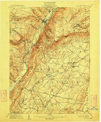
1906 Map of Ellenville
USGS Topo · Published 1909About this map
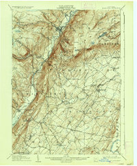
Ellenville serves as the focal point for this survey, situated where the Sandburg Creek meets the Rondout Creek at the base of the dramatic Shawangunk Ridge. The industrial and transportation legacy of the region is clearly visible, featuring the Delaware and Hudson Canal (Abandoned) running parallel to the New York Ontario and Western RR. This alignment illustrates the transition from mid-19th-century water transport to the rail dominance of the early 20th century. High atop the ridge, landmarks such as the Ice Caves, Sams Pt, and Lake Awosting overlook the valley floor.
Find a feature on this map
96 named features on this map. Tap any name to fly to it.
Don’t see what you’re looking for? This feature index may not catch every label — zoom into the map to look around manually.
Map Details
Editions of this 1906 Ellenville Map
7 editions found
Other maps of this area

1901 · Rosendale
USGS Topo · 1:62,500

1902 · Schunemunk
USGS Topo · 1:62,500

1903 · Newburg
USGS Topo · 1:62,500

1903 · Rosendale
USGS Topo · 1:62,500

1903 · Slide Mountain
USGS Topo · 1:62,500

1904 · Ellenville
USGS Topo · 1:62,500

1905 · Slide Mountain
USGS Topo · 1:62,500

1906 · Ellenville
USGS Topo · 1:62,500

1906 · Port Jervis
USGS Topo · 1:62,500

1906 · Goshen
USGS Topo · 1:62,500