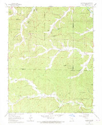
1968 Map of Ellington SE
USGS Topo · Published 1969About this map
Bozarth State Forest dominates the northern reaches of this landscape, where the terrain is marked by deep cuts like Hurricane Hollow and Webb Valley. Settlement is sparse, with the community of Hadley situated along a winding road in the center of the sheet. The area’s spiritual and social history is grounded in local landmarks such as Oak Grove Ch and Roland Ch, alongside several family and community burial grounds including Potter Cem and Copeland Cem.
Find a feature on this map
44 named features on this map. Tap any name to fly to it.
Don’t see what you’re looking for? This feature index may not catch every label — zoom into the map to look around manually.
Map Details
Editions of this 1968 Ellington SE Map
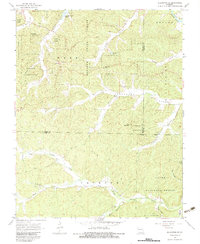
2 editions found
Other maps of this area

1932 · Piedmont
USGS Topo · 1:62,500

1934 · Williamsville
USGS Topo · 1:48,000

1935 · Piedmont
USGS Topo · 1:62,500

1940 · Williamsville
USGS Topo · 1:62,500

1943 · Ellington
USGS Topo · 1:62,500

1944 · Grandin
USGS Topo · 1:62,500

1945 · Ellington
USGS Topo · 1:62,500

1946 · Grandin
USGS Topo · 1:62,500

1949 · Rolla
USGS Topo · 1:250,000

1953 · Rolla
USGS Topo · 1:250,000