
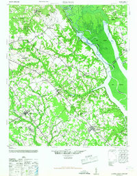
1946 Map of Elloree
USGS Topo · Published 1946About this map
The Congaree River and Santee River dominate this landscape during a period of transition, where the rising waters of Lake Marion begin to reshape the lowlands of South Carolina. The map captures a high density of rural institutions, including Kerswill Academy and numerous family-named landmarks like Wiles Crossroads and Langsynt Plantation. The interior is marked by an extensive network of churches and schools, such as Mt Pisgah Ch and St Peter Sch, which served the distributed agricultural communities between Fort Motte and Elloree.
Find a feature on this map
74 named features on this map. Tap any name to fly to it.
Don’t see what you’re looking for? This feature index may not catch every label — zoom into the map to look around manually.
Map Details
Editions of this 1946 Elloree Map
2 editions found
Other maps of this area

1920 · Eutawville
USGS Topo · 1:48,000

1920 · Bowman
USGS Topo · 1:48,000

1920 · Orangeburg
USGS Topo · 1:48,000

1921 · Orangeburg
USGS Topo · 1:62,500

1921 · Bowman
USGS Topo · 1:62,500

1921 · Eutawville
USGS Topo · 1:62,500

1943 · Bowman
USGS Topo · 1:62,500

1943 · Orangeburg
USGS Topo · 1:125,000

1943 · Orangeburg
USGS Topo · 1:62,500

1943 · Eutawville
USGS Topo · 1:62,500