
1972 Map of Elma
USGS Topo · Published 1976About this map
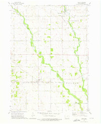
Elma and Alta Vista serve as the primary hubs in this agricultural landscape straddling the border of Howard and Chickasaw Counties. The region is defined by the winding paths of the Wapsipinicon River and its tributary, the Little Wapsipinicon River, which dictate the drainage patterns across Afton, Deerfield, and Washington townships. The Chicago and North Western railroad provides the industrial spine of the area, connecting these prairie towns to wider markets during the early 1970s. Local industry and infrastructure are represented by scattered Quarries, a Gravel Pit, and municipal features like the Sewage Disposal Pond near Elma. Genealogists will find the locations of Calvary Cem and Deerfield Cem particularly useful for tracing family roots in this rural Iowa heartland.
Find a feature on this map
19 named features on this map. Tap any name to fly to it.
Don’t see what you’re looking for? This feature index may not catch every label — zoom into the map to look around manually.
Map Details
Editions of this 1972 Elma Map
This is the sole edition of this map. No revisions or reprints were ever made.
Other maps of this area

1954 · Mason City
USGS Topo · 1:250,000

1957 · Mason City
USGS Topo · 1:250,000

1958 · Mason City
USGS Topo · 1:250,000

1971 · Bassett
USGS Topo · 1:24,000

1971 · Colwell
USGS Topo · 1:24,000

1972 · Riceville
USGS Topo · 1:24,000
1972 · Ionia
USGS Topo · 1:24,000

1972 · Jerico
USGS Topo · 1:24,000
1972 · New Hampton
USGS Topo · 1:24,000

1981 · Lourdes
USGS Topo · 1:24,000