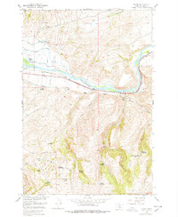
1951 Map of Elton
USGS Topo · Published 1978About this map
The Yellowstone River cuts through this high-country landscape, serving as the primary corridor for the Northern Pacific railroad and early water management systems. By the early 1950s, the irrigation network was well-defined by the Mission Ditch and a series of Windsor ditches, including the Upper Windsor Ditch and Lower Windsor Ditch. These engineering works sustained a string of ranches along the river valley, such as the Windsor Ranch, Wilburn Ranch, and Peterson Ranch.
Find a feature on this map
39 named features on this map. Tap any name to fly to it.
Don’t see what you’re looking for? This feature index may not catch every label — zoom into the map to look around manually.
Map Details
Editions of this 1951 Elton Map
5 editions found

Other maps of this area

1891 · Livingston
USGS Topo · 1:250,000

1893 · Livingston
USGS Topo · 1:250,000

1947 · Bozeman
USGS Topo · 1:250,000

1948 · Bozeman
USGS Topo · 1:250,000

1951 · Mount Rae
USGS Topo · 1:24,000

1951 · Grannis
USGS Topo · 1:24,000

1951 · Kelly Hills
USGS Topo · 1:24,000

1951 · Livingston Peak
USGS Topo · 1:24,000

1951 · Springdale
USGS Topo · 1:24,000

1951 · Mc Leod Basin
USGS Topo · 1:24,000