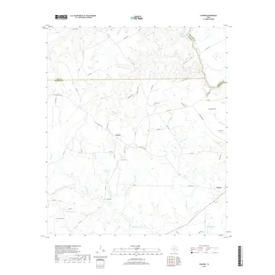
2019 Map of Elwood
USGS Topo · Published 2019About this map
Old San Antonio Rd and the Osr trace ancient routes across this landscape where Leon, Madison, and Houston counties meet. The settlement of Elwood sits at a crossroads of these historic thoroughfares, surrounded by family-named landmarks and water bodies like Big Dickey Lake and Slaughter Lake. Further east, the village of Midway borders the bottomlands near the Trinity River, which serves as a natural boundary for the region.
Find a feature on this map
68 named features on this map. Tap any name to fly to it.
Don’t see what you’re looking for? This feature index may not catch every label — zoom into the map to look around manually.
Map Details
Editions of this 2019 Elwood Map
This is the sole edition of this map. No revisions or reprints were ever made.
Other maps of this area

1953 · Palestine
USGS Topo · 1:250,000

1954 · Beaumont
USGS Topo · 1:250,000

1957 · Beaumont
USGS Topo · 1:250,000

1957 · Palestine
USGS Topo · 1:250,000
1962 · Connor
USGS Topo · 1:24,000
1962 · Baker Lake
USGS Topo · 1:24,000
1963 · Madisonville
USGS Topo · 1:24,000
1964 · Sand Ridge
USGS Topo · 1:24,000
1964 · Austonio
USGS Topo · 1:24,000
1964 · Middleton
USGS Topo · 1:24,000