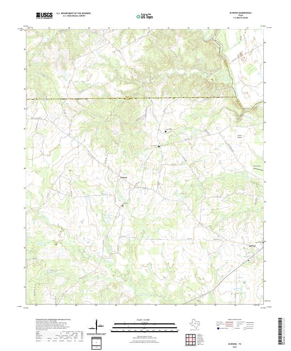
2022 Map of Elwood
USGS Topo · Published 2022About this map
Elwood and Midway anchor this pocket of East Texas, where the boundaries of Leon, Houston, and Madison counties meet along the Trinity River. The landscape is defined by its water systems and cattle history, evidenced by Cattle Trail Rd and the broad expanse of Goose Prairie in the east. Regional connectivity is highlighted by the Old San Antonio Rd, which intersects with several local routes that serve as the backbone for rural homesteads and agricultural operations.
Find a feature on this map
71 named features on this map. Tap any name to fly to it.
Don’t see what you’re looking for? This feature index may not catch every label — zoom into the map to look around manually.
Map Details
Editions of this 2022 Elwood Map
This is the sole edition of this map. No revisions or reprints were ever made.
Other maps of this area

1953 · Palestine
USGS Topo · 1:250,000

1954 · Beaumont
USGS Topo · 1:250,000

1957 · Beaumont
USGS Topo · 1:250,000

1957 · Palestine
USGS Topo · 1:250,000

1962 · Connor
USGS Topo · 1:24,000

1962 · Baker Lake
USGS Topo · 1:24,000

1963 · Madisonville
USGS Topo · 1:24,000

1964 · Sand Ridge
USGS Topo · 1:24,000

1964 · Austonio
USGS Topo · 1:24,000

1964 · Middleton
USGS Topo · 1:24,000