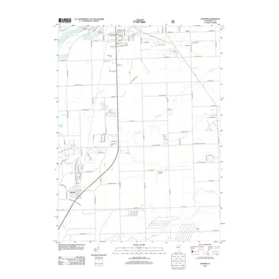
2012 Map of Elwood
USGS Topo · Published 2012About this map
Elwood sits at the southwestern intersection of several local transport corridors, including a rail line and major thoroughfares like E Mississippi Ave. The landscape is defined by the drainage basins of Jackson Cr and Prairie Cr, which carve through the primarily agricultural and residential terrain of Will County. Evidence of earlier settlement patterns persists in the distribution of family and community burial grounds, such as Brown Cem, North Ridge Cem, and Klinger Cem.
Find a feature on this map
111 named features on this map. Tap any name to fly to it.
Don’t see what you’re looking for? This feature index may not catch every label — zoom into the map to look around manually.
Map Details
Editions of this 2012 Elwood Map
This is the sole edition of this map. No revisions or reprints were ever made.
Other maps of this area

1890 · Des Plaines
USGS Topo · 1:62,500

1892 · Joliet
USGS Topo · 1:62,500

1892 · Wilmington
USGS Topo · 1:62,500

1894 · Des Plaines
USGS Topo · 1:62,500

1900 · Des Plaines
USGS Topo · 1:62,500

1901 · Des Plaines
USGS Topo · 1:62,500

1918 · Wilmington
USGS Topo · 1:62,500

1923 · Joliet
USGS Topo · 1:62,500

1929 · Brisbane
USGS Topo · 1:24,000
1929 · Mokena
USGS Topo · 1:24,000