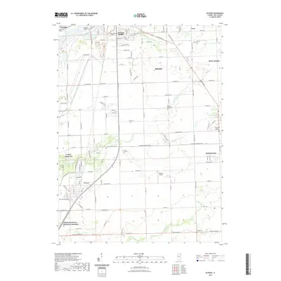
2021 Map of Elwood
USGS Topo · Published 2021About this map
The Des Plaines River flows through the northwest corner of this quadrangle, defining a landscape shaped by industrial waterways and expanding residential developments near Joliet. The southern portion of the sheet is prominently occupied by the Abraham Lincoln National Cemetery, a sprawling site of remembrance situated near Elwood. This area showcases a transition from the urban density of Preston Heights to the more open township layouts of Manhattan and New Lenox.
Find a feature on this map
108 named features on this map. Tap any name to fly to it.
Don’t see what you’re looking for? This feature index may not catch every label — zoom into the map to look around manually.
Map Details
Editions of this 2021 Elwood Map
This is the sole edition of this map. No revisions or reprints were ever made.
Other maps of this area

1890 · Des Plaines
USGS Topo · 1:62,500

1892 · Joliet
USGS Topo · 1:62,500

1892 · Wilmington
USGS Topo · 1:62,500

1894 · Des Plaines
USGS Topo · 1:62,500

1900 · Des Plaines
USGS Topo · 1:62,500

1901 · Des Plaines
USGS Topo · 1:62,500

1918 · Wilmington
USGS Topo · 1:62,500

1923 · Joliet
USGS Topo · 1:62,500

1929 · Brisbane
USGS Topo · 1:24,000
1929 · Mokena
USGS Topo · 1:24,000