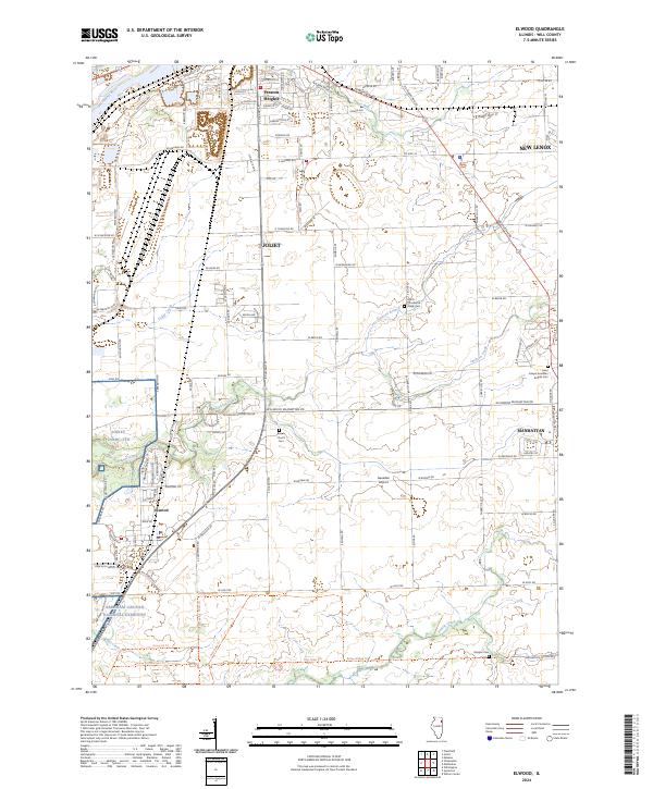
2024 Map of Elwood
USGS Topo · Published 2024About this map
Abraham Lincoln National Cemetery anchors the southwestern portion of this Will County landscape, illustrating the significant commemorative use of former industrial lands. The area is characterized by a transition from the urban fringes of Joliet and Preston Heights in the north toward the agricultural and residential expansions around Elwood and Manhattan. Waterways such as the Des Plaines River, Sugar Run, and Jackson Creek carve through the terrain, historically dictating the placement of early cemeteries like Brown Church Cem and North Providence Ridge Cem. The presence of the Joliet USARC/JTA training area further marks the region's long-standing connection to federal and military land use. This modern survey details the intricate road network, from established routes like Manhattan Rd to the private runways of Sweedler Airport, reflecting the contemporary character of this evolving Illinois corridor.
Find a feature on this map
107 named features on this map. Tap any name to fly to it.
Don’t see what you’re looking for? This feature index may not catch every label — zoom into the map to look around manually.
Map Details
Editions of this 2024 Elwood Map
This is the sole edition of this map. No revisions or reprints were ever made.
Other maps of this area

1890 · Des Plaines
USGS Topo · 1:62,500

1892 · Joliet
USGS Topo · 1:62,500

1892 · Wilmington
USGS Topo · 1:62,500

1894 · Des Plaines
USGS Topo · 1:62,500

1900 · Des Plaines
USGS Topo · 1:62,500

1901 · Des Plaines
USGS Topo · 1:62,500

1918 · Wilmington
USGS Topo · 1:62,500

1923 · Joliet
USGS Topo · 1:62,500

1929 · Brisbane
USGS Topo · 1:24,000
1929 · Mokena
USGS Topo · 1:24,000