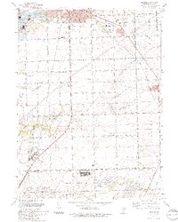
1993 Map of Elwood
USGS Topo · Published 1994About this map
The Joliet Ammunitions Plant dominates the southern landscape of this mid-1990s survey, illustrating the significant military and industrial footprint in the area. Near the village of Elwood, the terrain is defined by a dense network of transit, including the Chicago and North Western and Illinois Central Railroad, alongside numerous pipelines. The map captures a moment when industrial utility and conservation efforts existed side-by-side, seen in the proximity of a Quarry and Gravel Pit to the Sugar Creek Co Forest Preserve and Zalor Co Forest Preserve.
Find a feature on this map
56 named features on this map. Tap any name to fly to it.
Don’t see what you’re looking for? This feature index may not catch every label — zoom into the map to look around manually.
Map Details
Editions of this 1993 Elwood Map
This is the sole edition of this map. No revisions or reprints were ever made.
Other maps of this area

1890 · Des Plaines
USGS Topo · 1:62,500

1892 · Joliet
USGS Topo · 1:62,500

1892 · Wilmington
USGS Topo · 1:62,500

1894 · Des Plaines
USGS Topo · 1:62,500

1900 · Des Plaines
USGS Topo · 1:62,500

1901 · Des Plaines
USGS Topo · 1:62,500

1918 · Wilmington
USGS Topo · 1:62,500

1923 · Joliet
USGS Topo · 1:62,500

1929 · Brisbane
USGS Topo · 1:24,000
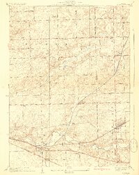
1929 · Mokena
USGS Topo · 1:24,000