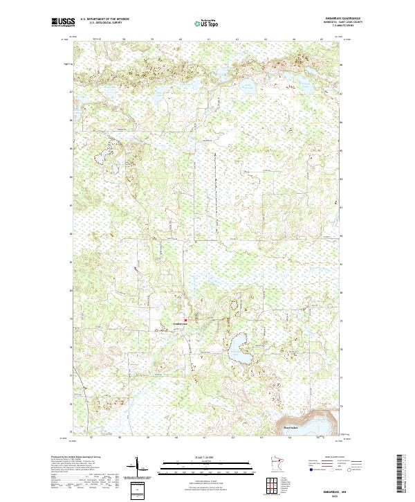
2022 Map of Embarrass
USGS Topo · Published 2022About this map
Embarrass serves as the central hub of this Northern Minnesota landscape, situated amidst a dense network of water bodies and wetlands in St. Louis County. The terrain is defined by the winding course of the Embarrass River, which flows southward through the quadrangle toward the community of Hoyt Lakes on the southern edge. The area is notable for its extensive lake systems, including the Lempia Lakes, Five Lake, and the cluster of Falls Lakes and Little Birch Lake to the north.
Find a feature on this map
54 named features on this map. Tap any name to fly to it.
Don’t see what you’re looking for? This feature index may not catch every label — zoom into the map to look around manually.
Map Details
Editions of this 2022 Embarrass Map
This is the sole edition of this map. No revisions or reprints were ever made.
Other maps of this area

1949 · Aurora
USGS Topo · 1:24,000

1949 · Isaac Lake
USGS Topo · 1:24,000

1949 · Allen
USGS Topo · 1:24,000

1949 · Embarrass
USGS Topo · 1:24,000

1950 · Isaac Lake
USGS Topo · 1:24,000

1950 · Embarrass
USGS Topo · 1:24,000

1950 · Allen
USGS Topo · 1:24,000

1950 · Aurora
USGS Topo · 1:24,000

1950 · Biwabik
USGS Topo · 1:24,000

1950 · Biwabik NE
USGS Topo · 1:24,000