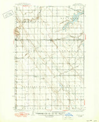
1936 Map of Emerado
USGS Topo · Published 1950About this map
Turtle River meanders across this Grand Forks County landscape, carving through a region defined by its precise agrarian grid and early 20th-century rail connectivity. The Great Northern railroad corridor serves as the primary axis for development, anchoring the prairie settlements of Arvilla, Emerado, and Ojata. This 1930s survey reveals a densely organized rural social structure, where community life was anchored by local landmarks like the Blooming Town Hall and a network of numbered schoolhouses such as School No 7 and School No 50.
Find a feature on this map
34 named features on this map. Tap any name to fly to it.
Don’t see what you’re looking for? This feature index may not catch every label — zoom into the map to look around manually.
Map Details
Editions of this 1936 Emerado Map
3 editions found
Other maps of this area

1926 · Ardoch
USGS Topo · 1:62,500

1934 · Emerado
USGS Topo · 1:48,000

1934 · Grand Forks
USGS Topo · 1:62,500

1936 · Emerado
USGS Topo · 1:62,500

1936 · Larimore
USGS Topo · 1:62,500

1938 · Grand Forks
USGS Topo · 1:62,500

1952 · Grand Forks
USGS Topo · 1:250,000

1952 · Thief River Falls
USGS Topo · 1:250,000

1956 · Thief River Falls
USGS Topo · 1:250,000

1956 · Grand Forks
USGS Topo · 1:250,000