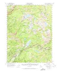
1955 Map of Emigrant Gap
USGS Topo · Published 1974About this map
The Southern Pacific railroad corridor and the high Sierra Nevada watershed define this mid-1950s landscape across the border of Nevada, Sierra, and Placer counties. Settlement patterns are largely driven by hydraulic and hard-rock mining legacy, evidenced by sites like Baltimore Town (Site), Graniteville, and Omega. The map shows a complex water management system of flumes, siphons, and tunnels connecting major reservoirs such as Bowman Lake and Lake Spaulding. High-altitude recreation and utility infrastructure are well-established, featuring the Marin-Sierra Boy Scout Camp, the Blue Canyon weather station, and an Emergency Landing Field. This era predates much of the modern interstate development, focusing instead on the established rail stops at Cisco and the rugged access provided by a network of jeep trails and gaging stations necessary for monitoring the South Yuba River and Middle Yuba River.
Find a feature on this map
187 named features on this map. Tap any name to fly to it.
Don’t see what you’re looking for? This feature index may not catch every label — zoom into the map to look around manually.
Map Details
Editions of this 1955 Emigrant Gap Map
4 editions found
Other maps of this area

1890 · Sierraville
USGS Topo · 1:125,000

1891 · Downieville
USGS Topo · 1:125,000

1891 · Colfax
USGS Topo · 1:125,000

1891 · Truckee
USGS Topo · 1:125,000

1892 · Sierraville
USGS Topo · 1:125,000

1892 · Colfax
USGS Topo · 1:125,000

1893 · Truckee
USGS Topo · 1:125,000

1893 · Downieville
USGS Topo · 1:125,000

1894 · Colfax
USGS Topo · 1:125,000

1894 · Sierraville
USGS Topo · 1:125,000