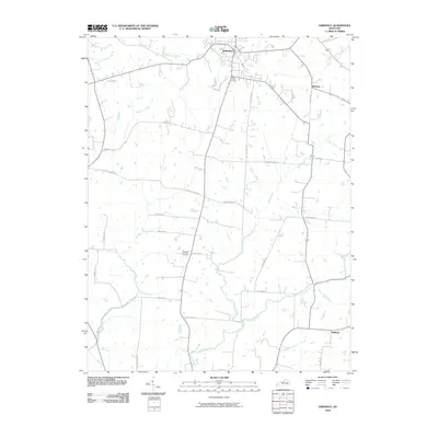
2010 Map of Eminence
USGS Topo · Published 2010About this map
Eminence serves as the primary hub in this portion of the Bluegrass region, where established road networks and natural drainage systems define the landscape. The layout of the area is heavily influenced by its watercourses, including the Little Kentucky River and East Fork Floyds Fork in the north, while Clear Creek and Fox Run meander through the central and southern reaches. These streams historically dictated the placement of early settlements and agricultural boundaries, a pattern still visible in the modern topography.
Find a feature on this map
31 named features on this map. Tap any name to fly to it.
Don’t see what you’re looking for? This feature index may not catch every label — zoom into the map to look around manually.
Map Details
Editions of this 2010 Eminence Map
This is the sole edition of this map. No revisions or reprints were ever made.
Other maps of this area

1923 · Waddy
USGS Topo · 1:48,000

1925 · Mount Eden
USGS Topo · 1:48,000

1927 · Mount Eden
USGS Topo · 1:62,500

1928 · New Castle
USGS Topo · 1:48,000

1929 · Taylorsville
USGS Topo · 1:62,500

1932 · New Castle
USGS Topo · 1:62,500

1932 · La Grange
USGS Topo · 1:62,500

1954 · Ballardsville
USGS Topo · 1:24,000
1954 · New Castle
USGS Topo · 1:24,000
1954 · Eminence
USGS Topo · 1:24,000