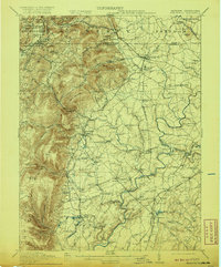
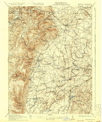
1911 Map of Emmitsburg
USGS Topo · Published 1920About this map
Emmitsburg stands as a primary hub within this borderland survey, where the rolling plains of Frederick County meet the steep eastern slopes of the Blue Mountain. The map reveals a landscape defined by its theological and educational institutions, most notably Mount St Marys and St Josephs Academy. A dense network of turnpikes and rail lines, including the Western Maryland RR and the Frederick RR, facilitate movement between established settlements like Thurmont and Woodsboro. Along the Monocacy River and its tributaries, numerous water-powered sites such as Eicholz Mill and Shyrocks Mill underscore the local milling economy. The presence of a Sanatorium near Sabillasville and the clustering of schools like Phillips Delight School provide specific points of interest for genealogists tracing early twentieth-century social infrastructure in north-central Maryland.
Find a feature on this map
117 named features on this map. Tap any name to fly to it.
Don’t see what you’re looking for? This feature index may not catch every label — zoom into the map to look around manually.
Map Details
Editions of this 1911 Emmitsburg Map
6 editions found

Other maps of this area

1884 · Harpers Ferry
USGS Topo · 1:125,000

1891 · Harpers Ferry
USGS Topo · 1:125,000

1893 · Frederick
USGS Topo · 1:125,000

1893 · Harpers Ferry
USGS Topo · 1:125,000

1894 · Frederick
USGS Topo · 1:125,000

1902 · Chambersburg
USGS Topo · 1:62,500

1908 · Middletown
USGS Topo · 1:48,000

1908 · Gettysburg
USGS Topo · 1:62,500

1908 · Ijamsville
USGS Topo · 1:62,500

1909 · Mount Airy
USGS Topo · 1:62,500