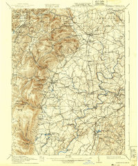
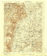
1911 Map of Emmitsburg
USGS Topo · Published 1939About this map
Emmitsburg and the surrounding foothills of the Catoctin Mountains define this landscape at the transition between Frederick County, Maryland, and Adams County, Pennsylvania. This area, surveyed during the first decade of the 1900s, shows a complex network of turnpikes and rail lines, including the Western Maryland Railroad and the Washington Frederick Ry. Settlement patterns are closely tied to the water power of Owens Creek and the Monocacy River, where multiple industrial sites like Eicholz Mill and Shyrocks Mill are documented. For genealogists and local historians, the map provides precise locations for landmark institutions such as St Joseph Academy and Mount St Marys, alongside numerous rural schools like Quirauk School and Springfield School. Evidence of early industrial activity appears at the Rockyhill Coppermine near Woodsboro, while several historic crossings like Mumma Ford and Devilbiss Bridge illustrate the era's transport infrastructure.
Find a feature on this map
103 named features on this map. Tap any name to fly to it.
Don’t see what you’re looking for? This feature index may not catch every label — zoom into the map to look around manually.
Map Details
Editions of this 1911 Emmitsburg Map
6 editions found

Other maps of this area

1884 · Harpers Ferry
USGS Topo · 1:125,000

1891 · Harpers Ferry
USGS Topo · 1:125,000

1893 · Frederick
USGS Topo · 1:125,000

1893 · Harpers Ferry
USGS Topo · 1:125,000

1894 · Frederick
USGS Topo · 1:125,000

1902 · Chambersburg
USGS Topo · 1:62,500

1908 · Middletown
USGS Topo · 1:48,000

1908 · Gettysburg
USGS Topo · 1:62,500

1908 · Ijamsville
USGS Topo · 1:62,500

1909 · Mount Airy
USGS Topo · 1:62,500