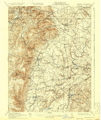
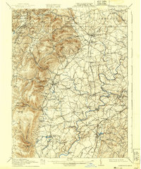
1911 Map of Emmitsburg
USGS Topo · Published 1943About this map
Emmitsburg and the surrounding borderlands of Frederick County and Adams County are defined by the eastern slopes of the Blue Ridge and a dense network of early 20th-century rural infrastructure. The Western Maryland Railroad winds through the hills, connecting mountain settlements like Blue Ridge Summit and Sabillasville to valley towns. The landscape is dotted with small-scale industrial sites and educational anchors, such as St Joseph's Academy, while the Monocacy River and Owens Creek support numerous local mills including Hoover Mill and Shyrocks Mill. This topography reveals the era's reliance on water power and rail transit before the modern highway system reshaped the region. Genealogists can find specific family-named landmarks like Hoffman Hill and Carrick Knob, alongside isolated institutions like the Phillips Delight School and Mount Zion Church.
Find a feature on this map
106 named features on this map. Tap any name to fly to it.
Don’t see what you’re looking for? This feature index may not catch every label — zoom into the map to look around manually.
Map Details
Editions of this 1911 Emmitsburg Map
6 editions found

Other maps of this area

1884 · Harpers Ferry
USGS Topo · 1:125,000

1891 · Harpers Ferry
USGS Topo · 1:125,000

1893 · Frederick
USGS Topo · 1:125,000

1893 · Harpers Ferry
USGS Topo · 1:125,000

1894 · Frederick
USGS Topo · 1:125,000

1902 · Chambersburg
USGS Topo · 1:62,500

1908 · Middletown
USGS Topo · 1:48,000

1908 · Gettysburg
USGS Topo · 1:62,500

1908 · Ijamsville
USGS Topo · 1:62,500

1909 · Mount Airy
USGS Topo · 1:62,500