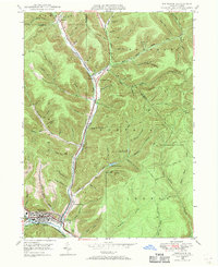
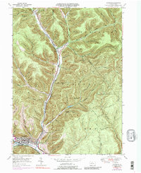
1948 Map of Emporium
USGS Topo · Published 1970About this map
Emporium serves as the industrial and social heart of this 1948 survey, where the Driftwood Branch and West Branch Sinnemahoning Creek converge. The Pennsylvania railroad follows the valley floor, connecting the borough to smaller settlements like Sizerville and Gardeau to the north. This corridor was a vital artery for the region's timber and transit history, evidenced by the dense network of drainage hollows and timber-era traces such as McDowell Trail and Switchback Trail.
Find a feature on this map
83 named features on this map. Tap any name to fly to it.
Don’t see what you’re looking for? This feature index may not catch every label — zoom into the map to look around manually.
Map Details
Editions of this 1948 Emporium Map
6 editions found

Other maps of this area

1941 · Benezette
USGS Topo · 1:62,500

1943 · Benezette
USGS Topo · 1:62,500

1945 · Driftwood
USGS Topo · 1:48,000

1945 · First Fork
USGS Topo · 1:24,000

1945 · Cameron
USGS Topo · 1:24,000

1947 · Cameron
USGS Topo · 1:24,000

1947 · First Fork
USGS Topo · 1:24,000

1948 · Crosby
USGS Topo · 1:62,500

1948 · Emporium
USGS Topo · 1:62,500

1948 · Keating Summit
USGS Topo · 1:24,000