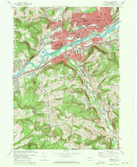
1969 Map of Endicott
USGS Topo · Published 1972About this map
The Susquehanna River defines this industrial and suburban landscape in the late 1960s, separating the bustling village of Endicott and the growing community of Endwell from the residential and agricultural reaches of Vestal to the south. The north bank is characterized by dense urban planning, featuring landmarks such as the Ideal Hospital, the Town Hall, and several educational institutions like the McGuinness School and Snapp Junior High School. This area reflects the mid-century peak of the Triple Cities, supported by the Erie-Lackawanna railroad lines.
Find a feature on this map
64 named features on this map. Tap any name to fly to it.
Don’t see what you’re looking for? This feature index may not catch every label — zoom into the map to look around manually.
Map Details
Editions of this 1969 Endicott Map
Other maps of this area

1901 · Apalachin
USGS Topo · 1:62,500

1904 · Binghamton
USGS Topo · 1:62,500

1904 · Apalachin
USGS Topo · 1:62,500

1906 · Catatonk
USGS Topo · 1:125,000

1934 · Castle Creek
USGS Topo · 1:24,000

1935 · Binghamton West
USGS Topo · 1:24,000

1942 · Binghamton West
USGS Topo · 1:31,680

1942 · Castle Creek
USGS Topo · 1:31,680

1943 · Montrose
USGS Topo · 1:62,500

1943 · Le Raysville
USGS Topo · 1:62,500