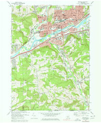
1969 Map of Endicott
USGS Topo · Published 1978About this map
The Susquehanna River anchors this mid-century view of the industrial and residential development spanning the Broome and Tioga county line. The northern bank is densely settled by the village of Endicott and the community of Endwell, where the Erie-Lackawanna railroad runs parallel to the river's course. This area is characterized by a concentrated network of schools and civic institutions, including St Anthonys Sch, Broad St Sch, and the Library. Across the water, Vestal serves as a suburban hub, featuring the Vestal Central Schools and Arnold Park.
Find a feature on this map
63 named features on this map. Tap any name to fly to it.
Don’t see what you’re looking for? This feature index may not catch every label — zoom into the map to look around manually.
Map Details
Editions of this 1969 Endicott Map
Other maps of this area

1901 · Apalachin
USGS Topo · 1:62,500

1904 · Binghamton
USGS Topo · 1:62,500

1904 · Apalachin
USGS Topo · 1:62,500

1906 · Catatonk
USGS Topo · 1:125,000

1934 · Castle Creek
USGS Topo · 1:24,000

1935 · Binghamton West
USGS Topo · 1:24,000

1942 · Binghamton West
USGS Topo · 1:31,680

1942 · Castle Creek
USGS Topo · 1:31,680

1943 · Montrose
USGS Topo · 1:62,500

1943 · Le Raysville
USGS Topo · 1:62,500