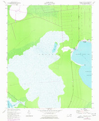
1953 Map of Engelhard NE
USGS Topo · Published 1977About this map
Stumpy Point and the adjacent Lake Worth settlement occupy a narrow strip of land between the marshy interior and the open waters of the North Carolina coast. This 1953 topographic sheet, updated with photorevisions in the mid-1970s, captures a landscape defined by the reach of Stumpy Point Bay and the vast Pamlico Sound. The community is anchored by the Full Gospel Tabernacle and a system of local lights guiding vessels through the shallow channels.
Find a feature on this map
19 named features on this map. Tap any name to fly to it.
Don’t see what you’re looking for? This feature index may not catch every label — zoom into the map to look around manually.
Map Details
Editions of this 1953 Engelhard NE Map
3 editions found
Other maps of this area

1943 · Roanoke Island
USGS Topo · 1:125,000

1951 · Long Shoal Point
USGS Topo · 1:24,000

1951 · Engelhard East
USGS Topo · 1:24,000

1953 · Wanchese
USGS Topo · 1:24,000

1953 · Engelhard NW
USGS Topo · 1:24,000

1953 · Buffalo City
USGS Topo · 1:24,000

1953 · Stumpy Point
USGS Topo · 1:24,000

1953 · East Lake SE
USGS Topo · 1:24,000

1953 · Engelhard NE
USGS Topo · 1:24,000

1955 · Wanchese
USGS Topo · 1:250,000