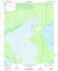
1953 Map of Engelhard NE
USGS Topo · Published 1989About this map
The coastal village of Stumpy Point serves as the focal point of this mid-century maritime landscape, situated where the land meets the expansive Stumpy Point Bay. The settlement is defined by its relationship with the surrounding waters of Pamlico Sound and the intricate network of inland bodies such as Lake Worth and Back Lake. The landscape is largely marshy and low-lying, with the Long Shoal River and Deep Creek draining the southern reaches.
Find a feature on this map
20 named features on this map. Tap any name to fly to it.
Don’t see what you’re looking for? This feature index may not catch every label — zoom into the map to look around manually.
Map Details
Editions of this 1953 Engelhard NE Map
3 editions found
Other maps of this area

1943 · Roanoke Island
USGS Topo · 1:125,000

1951 · Long Shoal Point
USGS Topo · 1:24,000

1951 · Engelhard East
USGS Topo · 1:24,000

1953 · Wanchese
USGS Topo · 1:24,000

1953 · Engelhard NW
USGS Topo · 1:24,000

1953 · Buffalo City
USGS Topo · 1:24,000

1953 · Stumpy Point
USGS Topo · 1:24,000

1953 · East Lake SE
USGS Topo · 1:24,000

1953 · Engelhard NE
USGS Topo · 1:24,000

1955 · Wanchese
USGS Topo · 1:250,000