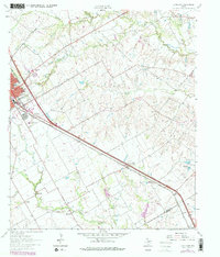
1962 Map of Ennis East
USGS Topo · Published 1979About this map
The Southern Pacific railroad corridor anchors this survey of eastern Ellis County, cutting a straight diagonal through the landscape past Alma and toward Rice. On the western edge of the sheet, the Ennis townsite expands toward the Ennis Corporate Limit, revealing community landmarks such as the Odd Fellows and Rebekahs Home and St Johns church.
Find a feature on this map
28 named features on this map. Tap any name to fly to it.
Don’t see what you’re looking for? This feature index may not catch every label — zoom into the map to look around manually.
Map Details
Editions of this 1962 Ennis East Map
3 editions found
Other maps of this area

1954 · Dallas
USGS Topo · 1:250,000

1956 · Ennis
USGS Topo · 1:62,500

1958 · Dallas
USGS Topo · 1:250,000

1961 · Chatfield
USGS Topo · 1:24,000

1962 · Emhouse
USGS Topo · 1:24,000

1962 · Ennis West
USGS Topo · 1:24,000

1962 · Ennis East
USGS Topo · 1:24,000

1962 · Rosser SW
USGS Topo · 1:24,000

1962 · Cryer Creek
USGS Topo · 1:24,000
1962 · Bristol
USGS Topo · 1:24,000