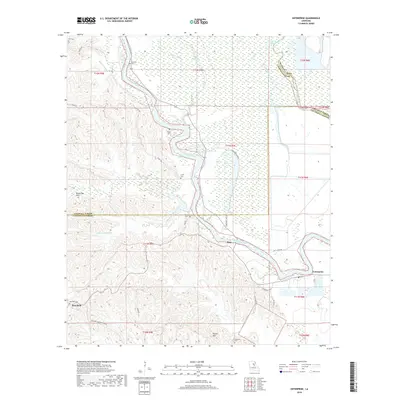
2018 Map of Enterprise
USGS Topo · Published 2018About this map
The Ouachita River carves a winding path through this corner of Louisiana, serving as a boundary for three parishes and a lifeline for the communities of Duty and Enterprise. The landscape is defined by the contrast between the low-lying river bottomlands, filled with features like Horseshoe Lake and Grass Bayou, and the elevated terrain of the Bayou Dan Hills to the west. Local genealogy is well-documented through a network of family and community burial grounds, including McSween Cem, Wyant Cem, and Lively Cem. The road network, featuring routes like the Duty-Ferry Rd and Columbia Harrisonburg Rd, reflects the historical transit patterns between the river landings and the upland settlements like Rosefield. This survey captures the rural character of the region where the Boeuf River meets the Ouachita, preserving the locations of remote homesteads and local landmarks such as Rocky Hill.
Find a feature on this map
43 named features on this map. Tap any name to fly to it.
Don’t see what you’re looking for? This feature index may not catch every label — zoom into the map to look around manually.
Map Details
Editions of this 2018 Enterprise Map
This is the sole edition of this map. No revisions or reprints were ever made.
Other maps of this area

1939 · Fort Necessity
USGS Topo · 1:62,500

1940 · Columbia
USGS Topo · 1:62,500

1941 · Harrisonburg
USGS Topo · 1:62,500

1953 · Alexandria
USGS Topo · 1:250,000

1953 · Natchez
USGS Topo · 1:250,000

1955 · Jackson
USGS Topo · 1:250,000

1955 · Shreveport
USGS Topo · 1:250,000

1955 · Alexandria
USGS Topo · 1:250,000

1955 · Olla
USGS Topo · 1:62,500

1956 · Shreveport
USGS Topo · 1:250,000