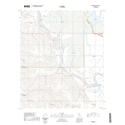
2020 Map of Enterprise
USGS Topo · Published 2020About this map
The Ouachita River snakes through the center of this landscape, defining the boundary between the lowland swamps and the rising ground of the Bayou Dan Hills. Near the river's edge, the settlement of Duty sits at a critical junction where Duty-Ferry Rd once facilitated transport across the water. The map reveals a high concentration of family and community burial sites, including Blythe Cem, Wyant Cem, and McSween Cem, which offer significant value for genealogical research in this part of Catahoula Parish. To the south, the terrain becomes increasingly dissected by watercourses like Hooter Cr and South Fork Bayou Dan. The community of Enterprise stands near the southeastern bend of the river, while Rosefield and its associated Rosefield Cem mark the southwestern highlands, illustrating the shift from river-bottom commerce to upland settlement patterns.
Find a feature on this map
41 named features on this map. Tap any name to fly to it.
Don’t see what you’re looking for? This feature index may not catch every label — zoom into the map to look around manually.
Map Details
Editions of this 2020 Enterprise Map
This is the sole edition of this map. No revisions or reprints were ever made.
Other maps of this area

1939 · Fort Necessity
USGS Topo · 1:62,500

1940 · Columbia
USGS Topo · 1:62,500

1941 · Harrisonburg
USGS Topo · 1:62,500

1953 · Alexandria
USGS Topo · 1:250,000

1953 · Natchez
USGS Topo · 1:250,000

1955 · Jackson
USGS Topo · 1:250,000

1955 · Shreveport
USGS Topo · 1:250,000

1955 · Alexandria
USGS Topo · 1:250,000

1955 · Olla
USGS Topo · 1:62,500

1956 · Shreveport
USGS Topo · 1:250,000