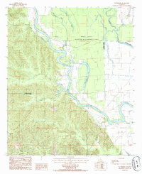
1984 Map of Enterprise
USGS Topo · Published 1985About this map
The Ouachita River and Boeuf River converge in this deltaic landscape of Catahoula Parish, where the water dictates the patterns of settlement and land use. The map reveals the winding oxbow of Horseshoe Lake and the dense network of tributaries including Wade Bayou, Sandy Bayou, and Bayou Dan that drain the western Hills. Along the southern banks, the small communities of Enterprise and Duty sit at the edge of the bottomlands, while Rosefield occupies higher ground to the west. Much of the northern terrain is preserved as the Boeuf State Wildlife Management Area, reflecting a landscape dominated by floodplains. Researchers will find interest in the river navigation markers like Mile 89 and the early infrastructure indicated by the Road On Levee, which protects the low-lying settlements from the shifting river courses.
Find a feature on this map
24 named features on this map. Tap any name to fly to it.
Don’t see what you’re looking for? This feature index may not catch every label — zoom into the map to look around manually.
Map Details
Editions of this 1984 Enterprise Map
This is the sole edition of this map. No revisions or reprints were ever made.
Other maps of this area

1939 · Fort Necessity
USGS Topo · 1:62,500

1940 · Columbia
USGS Topo · 1:62,500

1941 · Harrisonburg
USGS Topo · 1:62,500

1953 · Alexandria
USGS Topo · 1:250,000

1953 · Natchez
USGS Topo · 1:250,000

1955 · Jackson
USGS Topo · 1:250,000

1955 · Shreveport
USGS Topo · 1:250,000

1955 · Alexandria
USGS Topo · 1:250,000

1955 · Olla
USGS Topo · 1:62,500

1956 · Shreveport
USGS Topo · 1:250,000